Introduction
Aerial surveying, also known as aerial mapping or aerial photography, is the process of collecting geospatial data from aerial platforms such as airplanes and drones.
It importance cannot be underestimated as it plays a vital role in various industries including urban planning, agriculture, forestry, and environmental monitoring.
This blog post will discuss the different methods and uses of it in Canada, highlighting its significance in these industries.
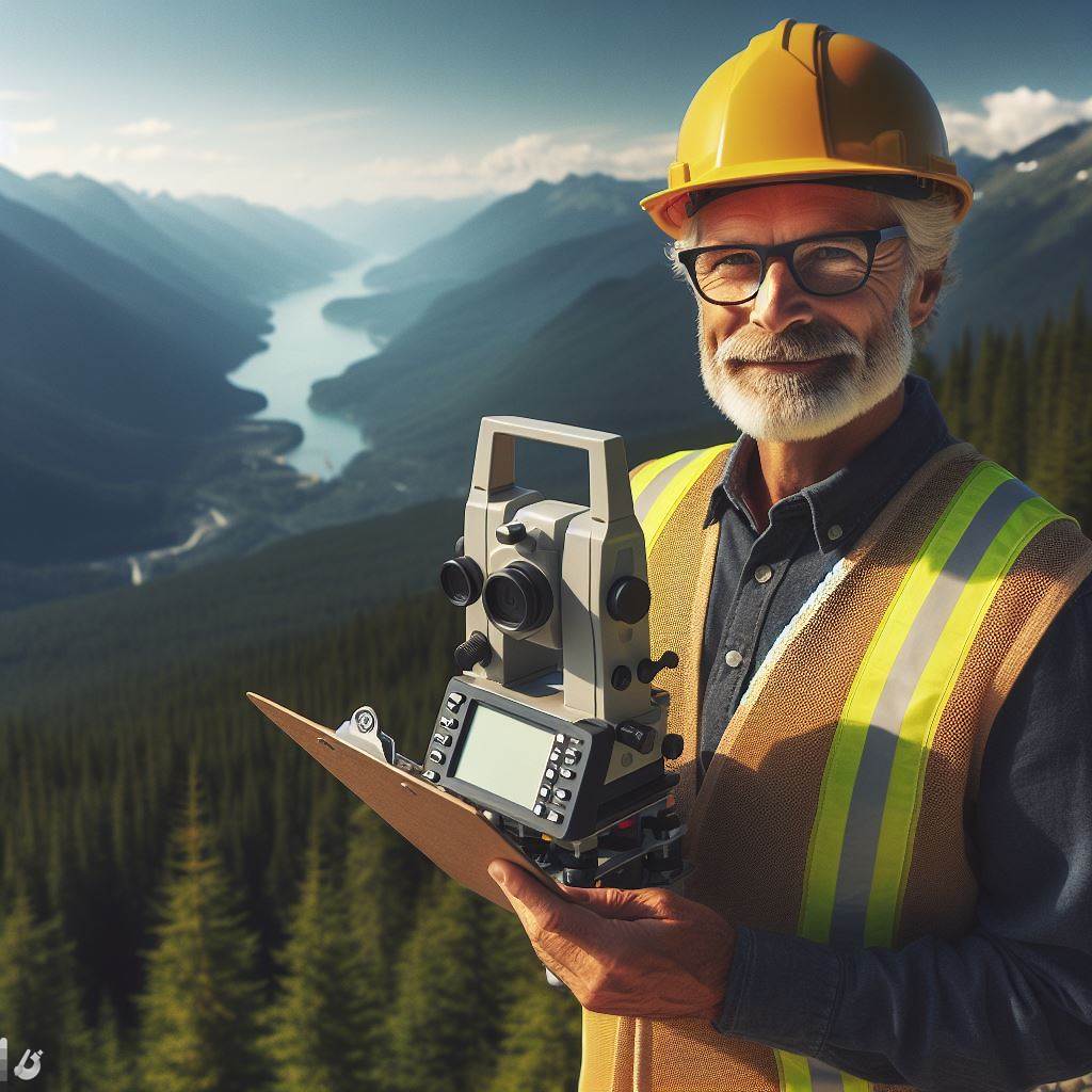
In the vast expanse of Canada’s diverse landscapes, the application of it stands as a pivotal methodology, revolutionizing our understanding of geographical terrains.
From the dense forests of British Columbia to the sprawling tundra of the Arctic, the utilization of advanced aerial surveying methods has become an indispensable tool for acquiring precise and comprehensive spatial data.
This exploration delves into the intricate techniques employed in aerial mapping, shedding light on its varied uses and the transformative impact it has on fields ranging from environmental monitoring to urban planning.
Join us on a journey through the skies as we unravel the intricacies of aerial surveying, exploring its methods and unveiling the myriad ways it contributes to shaping our perception of Canada’s geographical tapestry.
Read: Navigating Surveyor Career Paths in Canada
Methods of Aerial Surveying in Canada
Aerial surveying in Canada relies on various methods to gather accurate and comprehensive data for mapping and understanding the country’s geography.
Three key methods used are photogrammetry, LiDAR, and remote sensing.
Each method serves a distinct purpose and has unique applications in different contexts.
Photogrammetry
Photogrammetry is a technique that involves capturing aerial photographs to create precise maps.
This method plays a vital role in mapping land cover changes and identifying potential environmental issues.
The process of capturing aerial photographs for mapping purposes requires specialized equipment and skilled professionals.
By analyzing these aerial images, experts can accurately measure distances and create detailed maps.
An example of a photogrammetry application in Canada is the mapping of land cover changes.
By comparing aerial imagery taken over time, researchers can identify changes in vegetation, urban development, and natural features.
This information helps in monitoring land use patterns, resource management, and environmental conservation efforts.
LiDAR (Light Detection and Ranging)
LiDAR, also known as Light Detection and Ranging, is another method commonly used in aerial surveying in Canada.
It involves using lasers to measure distances and create high-resolution 3D models.
By bouncing laser pulses off the Earth’s surface, LiDAR technology accurately captures the elevation and shape of objects on the ground.
The use of LiDAR technology allows experts to create detailed models of landscapes, buildings, and natural features.
In Canada, LiDAR is utilized for mapping forest structure and biomass.
By analyzing the data collected through LiDAR, researchers can assess the health of forests, monitor changes in vegetation density, and identify potential areas of concern, such as diseased or damaged trees.
Remote Sensing
Remote sensing is a method that relies on aerial sensors to gather data from a distance.
Unlock Your Career Potential
Visualize a clear path to success with our tailored Career Consulting service. Personalized insights in just 1-3 days.
Get StartedThese sensors can capture various types of information, including electromagnetic radiation, thermal energy, and radar signals.
By utilizing remote sensing techniques, researchers can gather valuable data without physically accessing the study area.
In Canada, remote sensing plays a crucial role in monitoring ice cover changes in the Arctic.
Satellite imagery is used to track the extent and thickness of ice, providing valuable information for climate research and supporting the management of Arctic resources.
Remote sensing allows scientists to observe large areas continuously, providing an essential perspective on the changes occurring in remote and inaccessible regions.
In short, aerial surveying in Canada utilizes various methods, including photogrammetry, LiDAR, and remote sensing.
Each method serves specific purposes and has applications across different fields, from environmental monitoring to resource management.
By employing these advanced techniques, experts can gather precise data, create detailed maps, and gain valuable insights into the country’s geography and natural resources.
Read: GIS and Surveying: Evolving Practices in Canada
Uses of Aerial Surveying in Canada
Mapping and Land Surveying
Aerial surveying has revolutionized the field of mapping and land surveying in Canada.
The use of remote sensing technology combined with advanced aerial platforms allows for efficient and accurate data collection.
The benefits of using aerial surveying for mapping projects in Canada are remarkable.
First, aerial surveying enables the creation of high-resolution maps, providing detailed information about land features, topography, and infrastructure.
This level of accuracy is essential for urban planning, land evaluation, and resource management.
Aerial mapping also allows for the identification of potential hazards, such as flood-prone areas or unstable terrain, aiding in risk assessment and disaster management.
An example of a mapping and land surveying project in Canada where aerial surveying was employed is the development of a new city subdivision.
Aerial imagery and LiDAR data were collected to create topographic maps, determining property boundaries and assessing the feasibility of infrastructure development.
This comprehensive dataset, acquired through aerial surveying, served as a foundation for the entire planning process.
Environmental Monitoring
Aerial surveying has proven indispensable in tracking and monitoring environmental changes in Canada.
The ability to capture vast areas quickly and repeatedly provides crucial data for environmental assessment, conservation efforts, and climate change studies.
Environmental monitoring projects benefit greatly from aerial surveying because it enables the collection of data on a large scale.
Aerial imagery and remote sensing techniques allow for the identification and monitoring of changes in land cover, vegetation health, and wildlife habitats.
This information helps researchers and policymakers make informed decisions regarding land use and conservation practices.
An example of an environmental monitoring project in Canada utilizing aerial surveying is the tracking of forest fires.
Aerial surveys enable the detection and monitoring of fire dynamics, aiding in fire suppression efforts and resource allocation.
By regularly assessing burn patterns and fire severity through aerial surveys, fire management strategies can be improved, leading to more effective wildfire prevention and response.
Infrastructure Development
Aerial surveying plays a crucial role in the planning and design of infrastructure projects in Canada.
By capturing detailed aerial imagery and employing advanced surveying techniques, aerial surveying provides precise measurements and data required for infrastructure development.
The use of aerial surveying in infrastructure projects allows for efficient route planning, optimizing transportation networks and minimizing environmental impact.
By surveying large areas from an aerial perspective, the collection of data becomes faster and more cost-effective.
This data includes elevation profiles, existing infrastructure, and potential construction limitations.
An example of an infrastructure development project in Canada utilizing aerial surveying is the construction of a new highway.
Aerial surveys provide accurate and up-to-date information on the terrain, vegetation, and obstacles along the proposed route.
This data aids in the design and engineering processes, ensuring the safe and efficient construction of the highway.
Natural Resource Management
Aerial surveying is widely applied in assessing and managing natural resources in Canada.
From forestry to mining, aerial surveying enables the efficient evaluation and utilization of valuable resources.
The application of aerial surveying in natural resource management allows for the assessment of resource stock, identification of potential reserves, and monitoring of land use practices.
By collecting data on vegetation health, biomass, and geophysical properties, aerial surveying helps guide sustainable resource management strategies.
An example of a natural resource management project in Canada utilizing aerial surveying is the monitoring of oil sands extraction.
Aerial surveys provide an overview of the mining and extraction processes, helping to identify areas of concern, such as habitat fragmentation or water contamination.
This information aids in the development and implementation of mitigation measures, ensuring responsible resource extraction.
In essence, aerial surveying serves a variety of uses in Canada.
From mapping and land surveying to environmental monitoring, infrastructure development, and natural resource management, aerial surveying provides invaluable data for decision-makers and researchers.
Its ability to capture large areas quickly and accurately makes it an essential tool in numerous sectors across the country.
Read: Surveying Equipment: A Canadian Buyer’s Guide

Find Out More: Mech Engineering Tech: Latest in Canada
Delve into the Subject: Pros and Cons of Civil Engineering Careers
Challenges and Emerging Trends in Aerial Surveying
In the field of aerial surveying, several challenges and emerging trends have significant implications for the industry.
Technological Advancements
Technological advancements continue to revolutionize surveying methods, enabling faster, more accurate, and efficient data collection.
New technologies play a crucial role in meeting the growing demands of various sectors, including resource management, urban planning, and infrastructure development.
The introduction of Lidar technology has been a breakthrough in aerial surveying.
By using laser pulses, Lidar enables detailed 3D mapping and precise measurement of terrain elevation.
This technology provides crucial data for analyzing and planning infrastructure projects, flood management, and environmental assessments.
Advanced sensors, such as high-resolution cameras and multispectral sensors, further enhance data collection capabilities, enabling more detailed and accurate analysis.
Another significant technological advancement in aerial surveying is remote sensing technology.
Using aerial platforms, remote sensing enables the collection of data from a distance, eliminating the need for physical contact.
This technology allows surveyors to monitor vast areas quickly and capture data that would otherwise be challenging to obtain using traditional methods.
Unmanned Aerial Vehicles (UAVs) equipped with sensors have become increasingly popular in aerial surveying due to their cost-effectiveness and ability to access remote or difficult-to-reach locations.
Regulatory Framework
However, the adoption and implementation of these technologies face regulatory challenges and limitations in Canada.
Transport Canada, the regulatory body responsible for drone operations, has imposed restrictive regulations on altitude, distance, and airspace usage.
These regulations aim to ensure the safety of manned aircraft and the public.
Privacy laws also impose restrictions on capturing images or collecting data that may infringe on individuals’ privacy rights.
Environmental regulations are another factor influencing aerial surveying practices.
Surveyors must comply with regulations to minimize their impact on the environment during data collection.
Additionally, certain areas may have restricted airspace due to military or security concerns, limiting where aerial surveying can take place.
Privacy Concerns
Privacy concerns are of utmost importance when it comes to aerial surveying.
The capture of personal and sensitive information during surveying operations raises issues related to invasion of privacy.
Data security breaches pose risks of unauthorized access to collected data and its potential misuse.
Compliance with consent requirements is necessary to ensure that individuals’ personal information is captured legally and ethically.
Public perception also plays a significant role, as striking a balance between the benefits of this kind of surveying and addressing privacy concerns is crucial for industry stakeholders.
In a nutshell, aerial surveying in Canada faces various challenges and must adapt to emerging trends.
Technological advancements improve efficiency and data accuracy.
However, regulatory frameworks, particularly regarding drone operations and privacy laws, impose limitations.
Addressing privacy concerns and striking a balance between public interests and the benefits of aerial surveying are essential for the industry’s sustainable growth.
Read: Marine Surveying in Canada: Roles and Responsibilities
Conclusion
Aerial surveying plays a crucial role in Canada, offering numerous benefits to various industries.
It provides valuable data for mapping, monitoring, and resource management.
In this blog post, we discussed several methods and uses of it, including aerial photography, LiDAR, and thermal imaging. Each method has its own strengths and applications.
From assessing land use and urban planning to environmental monitoring and disaster response, it proves to be a versatile tool.
The future of aerial surveying in Canada looks promising.
Advancements in technology will continue to enhance accuracy, efficiency, and accessibility.
This will enable further exploration of remote areas and contribute to sustainable development.
It is invaluable for decision-making, resource management, and environmental protection in Canada.