Introduction
Surveying plays a crucial role in environmental management, ensuring accurate data for decision-making.
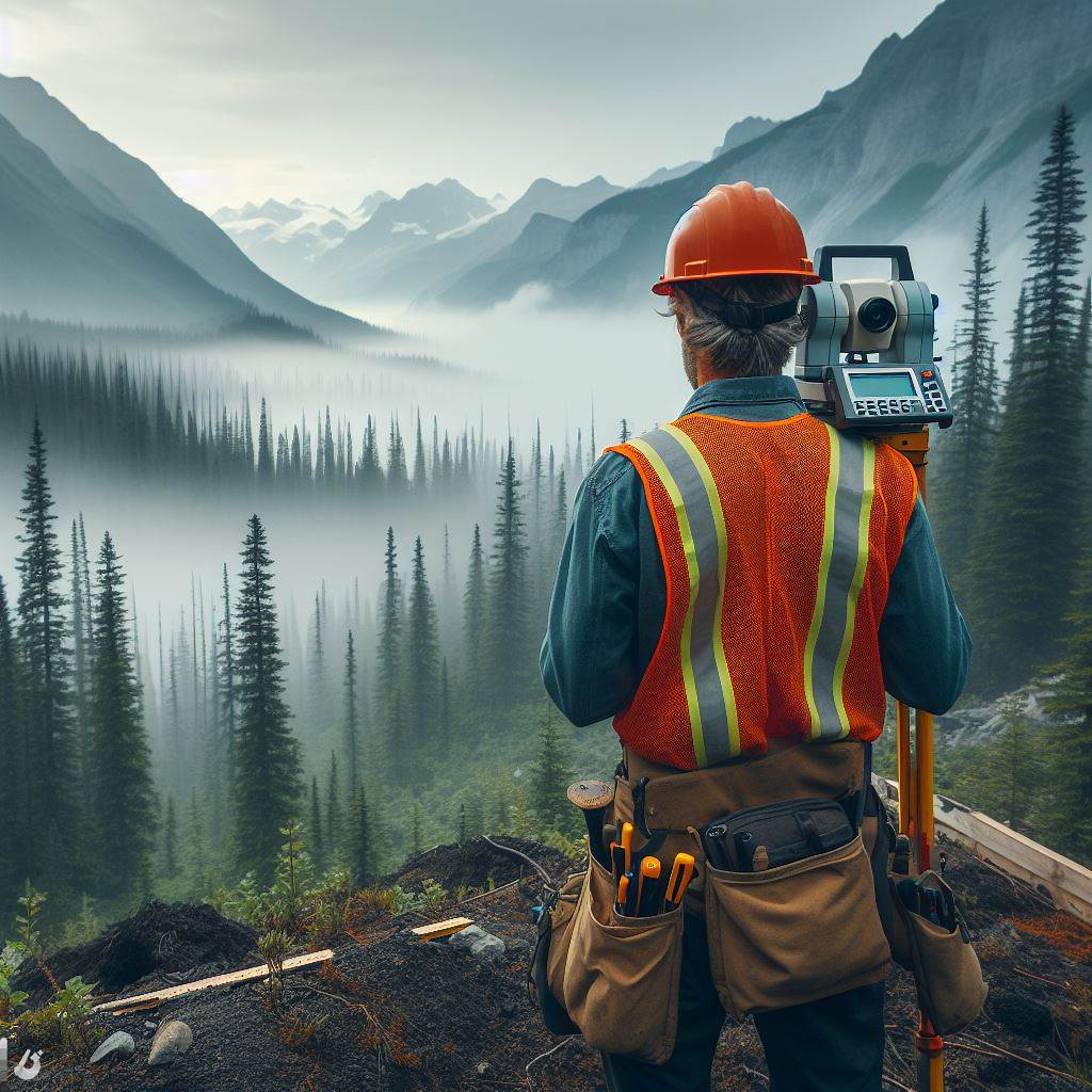
This blog post focuses on surveying in the Canadian context, highlighting its significance and challenges.
In Canada, surveying provides essential data for land management, resource extraction, and infrastructure development.
Accurate survey measurements contribute to effective environmental planning, monitoring, and conservation strategies.
Surveyors in Canada utilize advanced technologies like GPS, LiDAR, and remote sensing to improve accuracy and efficiency.
The integration of surveying and environmental sciences is vital for sustainable development and natural resource management.
Surveying enables the collection of precise spatial data, aiding in mapping and monitoring environmental changes over time.
In the Canadian context, surveying is particularly critical due to the vast and diverse landscape, including forests, mountains, and coastlines.
Environmental regulations in Canada rely on accurate survey data to ensure compliance and protect sensitive ecosystems.
This blog post explores the challenges and opportunities facing surveying professionals in the Canadian environmental sector.
By understanding the importance of surveying in the Canadian context, we can appreciate its role in effective environmental management.
Understanding Surveying
Definition and purpose of surveying
Surveying is the process of measuring and mapping the land to determine its boundaries and features.
The purpose of surveying is to provide accurate information for planning, development, and decision-making.
Various types of surveys and their applications in environmental assessments
- Topographic surveys measure and map the natural and man-made features of the land.
- Cadastral surveys determine and document property boundaries for land registration and ownership.
- Geodetic surveys measure the Earth’s shape and size, used for precise positioning and mapping.
- Hydrographic surveys map water bodies and measure depths for navigation safety and resource management.
- Environmental surveys assess and monitor the health, biodiversity, and impact of human activities on ecosystems.
Importance of accurate measurements in environmental planning and conservation efforts
- Accurate measurements in surveying are crucial for determining land use and development plans.
- Precise measurements enable effective management and conservation of natural resources.
- Accurate survey data ensures compliance with environmental regulations and minimizes environmental impacts.
- Proper assessment and monitoring aid in the preservation and restoration of ecosystems and biodiversity.
- Accurate measurements support climate change studies and help understand its impact on the environment.
- Reliable survey data facilitates informed decision-making and sustainable environmental practices.
- Accurate measurements are essential for the successful implementation of environmental and conservation projects.
- Precise surveying data allows for effective communication and collaboration between various stakeholders.
- Accurate measurements aid in the identification and management of environmental hazards and risks.
- Proper surveying ensures the preservation of cultural and historical sites during environmental planning.
- Accurate survey information supports the creation and maintenance of accurate and up-to-date maps.
- Precise measurements are essential for understanding and mitigating the impact of natural disasters on the environment.
Read: Indigenous Land Surveys in Canada: Unique Aspects
Key Surveying Techniques in Canada
Overview of commonly used surveying techniques in Canada
Surveying techniques play a crucial role in various industries in Canada, including construction, mining, and environmental management.
The most commonly used surveying technique is the Total Station, which combines electronic distance measurement and theodolite measurements.
Another widely used technique is leveling, which involves measuring vertical distances to determine elevations and slope gradients.
Traverse surveying is used to establish control networks and measure angles and distances between control points.
Boundary surveying helps define property lines and boundaries, ensuring accurate land ownership records.
GPS (Global Positioning System) technology and its role in environmental surveys
In this context, GPS technology is extensively used in environmental surveys to accurately locate and map features in the landscape.
GPS receivers use signals from satellites to determine precise coordinates, enabling the creation of highly accurate geospatial data.
Environmental surveys utilize GPS for habitat mapping, monitoring invasive species, and tracking wildlife movement.
GPS technology allows for efficient and precise data collection, enhancing the understanding and management of environmental resources.
Remote sensing methods such as LiDAR (Light Detection and Ranging) and aerial photography
LiDAR technology uses laser pulses to measure distances and create highly detailed 3D terrain models.
LiDAR is valuable for environmental surveys as it enables the identification of vegetation types, land cover changes, and forest inventory.
Unlock Your Career Potential
Visualize a clear path to success with our tailored Career Consulting service. Personalized insights in just 1-3 days.
Get StartedAerial photography captures high-resolution images from an aircraft, providing valuable visual information for environmental analysis.
Remote sensing methods like LiDAR and aerial photography help monitor and assess land use changes, vegetation health, and natural resource management.
The use of Geographic Information Systems (GIS) in surveying and mapping
GIS plays a critical role in surveying and mapping by analyzing and integrating spatial data with attribute data.
GIS software allows surveyors to overlay different thematic maps, facilitating the identification of relationships between features.
With GIS, surveyors can create and update databases containing information on topography, land use, and environmental characteristics.
GIS-based maps aid in decision-making processes related to urban planning, resource allocation, and environmental impact assessments.
In fact, surveying techniques in Canada are essential for accurate mapping, environmental monitoring, and effective resource management.
From traditional methods like total station and leveling to advanced technologies such as GPS, LiDAR, and GIS, these techniques provide valuable data for various industries and contribute to sustainable development and environmental stewardship.
Read: Women in Surveying: Changing Trends in Canada
Surveying for Environmental Assessments
The role of surveying in environmental impact assessments
Surveying plays a crucial role in environmental impact assessments by providing essential data and information.
This data helps in analyzing the impact of human activities on the environment.
Importance of surveying in identifying and mapping ecological features and habitats
Surveying is essential in identifying and mapping ecological features and habitats. It helps in assessing the biodiversity of an area and understanding the distribution of species and their habitats.
Surveyors utilize various techniques such as aerial surveys, ground-based surveys, and satellite imagery to collect accurate and detailed information.
This information enables environmental planners and researchers to formulate effective conservation strategies.
How surveying helps in determining land use and resource planning
Surveying is indispensable when it comes to determining land use and resource planning.
By collecting data on topography, soil types, and land cover, surveyors can assess the suitability of an area for particular land uses.
Moreover, surveying aids in identifying potential locations for infrastructure development, such as roads, bridges, and buildings, while considering environmental constraints.
This helps in minimizing adverse impacts on ecosystems and natural resources.
Surveying also assists in resource planning by providing accurate measurements of land area and volume.
This information is crucial in managing resources like forests, water bodies, and mineral deposits.
The use of GPS technology in surveying has revolutionized land use and resource planning.
It allows surveyors to accurately map and monitor changes in land cover and land use patterns over time.
This information is crucial in understanding the impact of human activities on the environment and making informed decisions for sustainable development.
In essence, surveying plays a vital role in environmental impact assessments, ecological mapping, and land use planning.
It provides valuable data for analyzing the impact of human activities on the environment, mapping ecological features and habitats, and determining suitable land uses.
Surveying techniques, coupled with advanced technologies like GPS, enable accurate measurements and monitoring of environmental changes.
This information is essential for effective environmental management and sustainable development.
Read: A Day in the Life of a Canadian Electrical Engineer
Canadian Environmental Surveying Regulations and Guidelines
Overview of federal and provincial regulations related to surveying in Canada
In Canada, surveying activities related to the environment are subject to both federal and provincial regulations.
These regulations ensure that surveyors adhere to specific standards and guidelines to protect the environment.
The federal government, through legislation such as the Canadian Environmental Assessment Act and the Fisheries Act, sets out rules for surveying activities that may have significant environmental impacts.
Provincial regulations vary across Canada, with each province having its own legislation governing surveying.
For example, in British Columbia, the Land Survey Act and the Natural Resources Act provide the legal framework for surveying practices.
Surveyors operating in Canada must be aware of and comply with these regulations to ensure their activities are legally and environmentally sound.
Important guidelines and standards followed by surveyors for environmental assessments
Surveyors in Canada follow various guidelines and standards when conducting environmental assessments.
These guidelines help ensure that surveying activities are thorough, accurate, and considerate of the environment.
The Canadian Council of Professional Land Surveyors (CCPLS) provides valuable guidance through its publication titled “Best Practices in Environmental Surveying.”
These best practices cover various aspects, including data collection, analysis, and reporting.
Other key guidelines followed by surveyors include those developed by organizations like the Canadian Standards Association (CSA) and the National Research Council (NRC).
These guidelines outline specific methodologies and protocols for conducting environmental surveys.
Surveyors also need to adhere to established industry practices, such as those outlined by the Association of Canada Land Surveyors (ACLS) and the Association of British Columbia Land Surveyors (ABCLS).
These practices ensure standardization and consistency in surveying procedures.
The role of professional organizations and licensing in maintaining surveying standards
Professional organizations and licensing play a crucial role in maintaining surveying standards in Canada.
These organizations ensure that surveyors possess the necessary qualifications and skills to carry out their work effectively and responsibly.
The Canadian Council of Professional Land Surveyors (CCPLS) is one such organization that promotes professional excellence among surveyors.
They establish professional standards, codes of ethics, and continuing education requirements.
Provincial land surveyor associations, such as the Association of Canada Land Surveyors (ACLS) and the Association of British Columbia Land Surveyors (ABCLS), also contribute to maintaining high surveying standards.
They regulate the profession and grant licenses to qualified surveyors.
Licensing requirements for surveyors typically involve a combination of academic qualifications, practical experience, and successful completion of licensing exams.
This ensures that only competent individuals can legally practice surveying.
By maintaining rigorous standards and licensing requirements, professional organizations help protect the environment and ensure that surveying activities are conducted with professionalism and accountability.
In general, surveying in Canada is governed by a combination of federal and provincial regulations, as well as guidelines and standards developed by professional organizations.
These regulations and guidelines aim to protect the environment and maintain high surveying standards.
Surveyors must familiarize themselves with these rules to ensure their work is both legal and environmentally responsible.
Read: Work-Life Balance: Mech Engineers CA
Uncover the Details: Essential Skills for Canadian Mech Engineers
Case Studies: Surveying for Environmental Conservation in Canada
Successful examples of surveying in Canada’s environmental conservation efforts
- One successful surveying project in Canada focused on assessing the population of endangered species.
- Another example is the survey conducted to study the impact of pollution on water bodies in Alberta.
- In British Columbia, surveying techniques were utilized to evaluate the health of old-growth forests.
- A noteworthy case is the survey that explored the migration patterns of bird species in Saskatchewan.
The outcomes and impact of those surveys in terms of protection and management of natural resources
The outcomes of these surveys have positively influenced environmental conservation efforts in Canada.
The survey on endangered species, for instance, provided insight into the population size and distribution of these vulnerable species.
This knowledge guided the development of targeted conservation programs aimed at preserving their habitats and promoting population recovery.
As a result, endangered species in Canada have witnessed increased protection and an improvement in their conservation status.
Similarly, the pollution survey in Alberta revealed the detrimental impact of industrial waste on water bodies.
This prompted authorities to implement stricter regulations on waste disposal, reducing pollution levels and safeguarding the quality of aquatic ecosystems.
The survey’s outcomes not only raised public awareness but also motivated industries to adopt cleaner practices, further benefiting the environment.
In British Columbia, the assessment of old-growth forests through surveying techniques brought attention to their ecological significance.
The findings influenced the establishment of protected areas, ensuring the preservation of these biodiverse ecosystems.
Additionally, sustainable logging practices were introduced, striking a balance between economic interests and long-term forest conservation.
Exploring bird migration patterns in Saskatchewan shed light on crucial stopover sites necessary for their survival.
This information aided in the identification and protection of these key areas, maintaining their integrity as vital habitats for various bird species.
By managing and preserving these stopover sites, Canada continues to support the migration and overall well-being of avian populations.
In a nutshell, surveying has been instrumental in Canada’s environmental conservation efforts.
Successful case studies have demonstrated the positive outcomes and impact of these surveys.
By providing crucial data and insights, surveying contributes to the protection and management of natural resources, enabling sustainable practices and preserving Canada’s rich biodiversity.
Find Out More: Top Canadian Architecture Schools Explored
Challenges and Future Trends
Challenges Faced by Surveyors in the Canadian Environmental Context
- Lack of standardized regulations across provinces poses obstacles for surveyors.
- Increasing demand for environmentally-conscious surveying practices requires adaptation and expertise.
- Navigating complex land ownership and indigenous rights issues adds complexity to environmental surveys.
- Climate change impacts, such as melting permafrost and rising sea levels, require adjustments in surveying techniques.
- Continuous advancements in technology necessitate ongoing training and equipment upgrades.
Emerging Trends and Technologies Shaping Surveying Practices
- Use of lidar technology for high-resolution topographic surveys revolutionizes data collection methods.
- Integration of Geographic Information Systems (GIS) enhances precision and analysis capabilities.
- Aerial surveying using drones provides cost-effective and efficient means of data acquisition.
- Mobile mapping systems enable real-time data collection and remote access to survey information.
- Implementation of augmented reality (AR) and virtual reality (VR) in surveying aids in visualizing projects.
- Adoption of Building Information Modeling (BIM) improves collaboration and reduces conflicts during construction.
- Utilization of advanced software and algorithms automates repetitive tasks, increasing efficiency and accuracy.
Surveyors operating in the Canadian environmental context face various challenges that require adaptability, expertise, and ongoing education.
The lack of standardized regulations, indigenous rights issues, and climate change impacts pose significant obstacles to surveying practices.
However, the future of surveying holds promising opportunities, driven by emerging trends and technologies.
The integration of lidar technology, GIS, drones, and mobile mapping systems has already revolutionized data collection methods and enhanced precision.
Augmented reality and virtual reality aid in visualizing projects, while the implementation of BIM improves collaboration during construction.
The adoption of advanced software, satellite positioning systems, and artificial intelligence algorithms further accelerates efficiency and accuracy in surveying.
As technology continues to advance, surveyors must embrace these emerging trends to navigate the challenges of conducting surveys in the Canadian environmental context successfully.
By staying informed and leveraging new tools and techniques, surveyors can shape the future of their profession and contribute to sustainable development and environmental protection.
Conclusion
To recap, this blog post highlighted the importance of surveying in environmental research in Canada.
Our exploration of surveying in the Canadian environmental context revealed key insights.
Firstly, we examined the vital role played by surveying techniques such as LiDAR and GIS in mapping and monitoring ecosystems.
These technologies enhance precision, aiding in effective environmental management.
Secondly, we underscored the importance of surveying in sustainable resource utilization.
Accurate data collection ensures informed decision-making, crucial for balancing development with conservation.
Surveying emerges as a linchpin in fostering Canada’s environmental sustainability.
Lastly, we encourage ongoing research endeavors in the surveying domain. Advancements in technology and methodologies can elevate our environmental monitoring capabilities.
By fostering collaboration and innovation, we can further refine surveying practices, ensuring a harmonious coexistence between development and nature.
Let this exploration serve as a catalyst for continuous exploration and refinement in surveying for environmental purposes in the Canadian landscape.
Surveying plays a crucial role in the sustainable management of Canada’s environment.
It is essential to encourage further exploration and research in the field of surveying for environmental purposes in Canada.