Introduction to Geology and Its Importance
Geology is the study of the Earth and its processes.
This field explores the composition, structure, and history of our planet.
Geologists assess natural resources and hazards.
Their work plays a vital role in understanding environment and climate changes.
Additionally, geology aids in locating essential resources like minerals and fossil fuels.
Geologists also contribute to construction and land use planning.
For example, they evaluate sites for potential building projects.
They help reduce risks associated with earthquakes and landslides.
Furthermore, geologists actively study natural events like volcanic eruptions.
This knowledge assists in disaster preparedness and response strategies.
In essence, geology is indispensable for sustainable development.
It provides insights that benefit society and the environment.
Field Tools
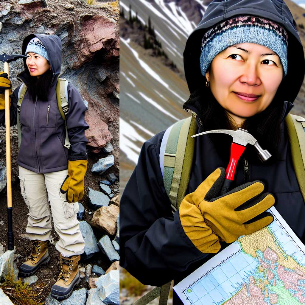
Hammers
Hammers are essential tools for geologists in the field.
They help break apart rocks and other geological samples efficiently.
Field hammers typically feature a heavy head and a sturdy handle.
Geologists choose hammers based on specific rock types they encounter.
Weight and balance significantly affect a geologist’s performance.
Chisels
Chisels complement hammers and provide enhanced precision.
Geologists often use chisels to create clean fractures in rocks.
Different chisel shapes cater to various types of rock work.
They help obtain small specimens for detailed study.
Additionally, chisels can be essential in archaeological digs.
Picks
Picks are invaluable for breaking through hard surfaces like gravel.
Many geologists keep a pick on hand for various terrains.
The pointed end of a pick helps penetrate tough materials easily.
Unlock Your Career Potential
Visualize a clear path to success with our tailored Career Consulting service. Personalized insights in just 1-3 days.
Get StartedSome picks offer a flat end for prying and lifting rocks.
Geologists rely on picks for tasks where hammers and chisels are inadequate.
Additional Field Tools
Beyond hammers, chisels, and picks, geologists use other tools.
Hand lenses are crucial for examining minerals closely.
Field notebooks allow geologists to record observations efficiently.
GPS devices help in mapping and tracking locations accurately.
Finally, safety equipment ensures geologists stay protected during fieldwork.
Surveying Instruments
Compasses
Compasses are essential tools for geologists during field surveys.
These instruments help determine direction and navigate diverse terrains.
Traditional magnetic compasses guide geologists in understanding geological formations.
Digital compasses offer enhanced accuracy and user-friendly interfaces.
Some compasses even integrate altimeters for elevation measurement.
Moreover, compasses can be used in conjunction with maps to pinpoint locations.
GPS Devices
Global Positioning System (GPS) devices have transformed geological surveying.
These devices provide real-time location data and precise coordinates.
Geologists rely on GPS for tracking their movements in remote regions.
GPS also aids in the collection of spatial data for research purposes.
With improved satellite technology, accuracy has significantly increased.
Additionally, GPS devices can integrate with other software for advanced analysis.
Using Compasses and GPS Together
Sometimes, geologists use compasses and GPS devices together.
This combination enhances data accuracy and field efficiency.
For example, a compass may direct a geologist to a site, while GPS verifies the location.
Furthermore, they help in creating detailed and accurate maps.
Team members can share their GPS coordinates to stay coordinated during expeditions.
You Might Also Like: Educational Requirements for Canadian Epidemiologists
Sampling Equipment
Core Samplers
Core samplers are essential for geologists working with subsurface materials.
These tools collect cylindrical sections of rock and soil from various depths.
Typically, they comprise a hollow tube with a cutting edge.
Geologists use core samplers to analyze geological formations accurately.
Moreover, this equipment helps in determining mineral composition and structure.
Popular models include diamond core drills and rotary core samplers.
Diamond core drills are preferred for hard rock formations.
They provide high-quality samples with minimal disturbance.
On the other hand, rotary core samplers are versatile and suitable for various substrates.
Both types allow geologists to gather data essential for resource exploration.
Soil Augers
Soil augers are critical tools used for collecting soil samples.
These tools typically have a helical screw blade that excavates soil efficiently.
Geologists often select augers based on the type of soil and depth required.
Manual augers are lightweight and ideal for shallow sampling.
Conversely, powered augers are used for deeper or more challenging sites.
Various models are available, including post hole augers and push-type augers.
Post hole augers dig deeper holes for plantings and borehole sampling.
Push-type augers are easy to use in soft to moderately firm soils.
Both types enable precise soil analysis for environmental studies and construction projects.
Choosing the Right Equipment
Selecting the appropriate sampling equipment is crucial for success in geological studies.
It depends on specific project requirements and environmental conditions.
For example, consider the soil type, depth, and sample quality needed.
Additionally, budget constraints might influence the choice of equipment.
Therefore, geologists should evaluate their options thoroughly.
Ultimately, the right tools enhance data accuracy and project outcomes.
Discover More: How Physicists Contribute To Technological Innovation
Analytical Tools: Stereoscopes and Polarizing Microscopes
Overview of Analytical Tools
Geologists often rely on specialized analytical tools for their research.
Stereoscopes provide a three-dimensional view of geological samples.
Polarizing microscopes allow for the examination of minerals under polarized light.
Understanding Stereoscopes
Stereoscopes facilitate the detailed visualization of rock structures.
They help geologists identify mineral compositions accurately.
Furthermore, these tools are essential for studying fossils and sediment textures.
Benefits of Using Stereoscopes
Stereoscopes enhance spatial perception of geological features.
The enhanced depth perception aids in making precise observations.
Consequently, geologists can draw more accurate conclusions about geological formations.
Exploring Polarizing Microscopes
Polarizing microscopes are crucial for analyzing thin sections of rocks.
They help in identifying crystalline structures and mineral properties.
These microscopes reveal optical phenomena that are invisible to the naked eye.
Advantages of Polarizing Microscopes
Using polarizing microscopes increases understanding of mineralogy.
They allow for the determination of mineral composition through birefringence.
Thus, geologists gather vital information about geological history.
Applications of Analytical Tools
Both stereoscopes and polarizing microscopes have diverse applications.
Geologists use them in research, education, and mineral exploration.
Moreover, these tools aid in environmental assessments and resource management.
Find Out More: Inspiring Stories of Geneticists Shaping Canadian Science
Safety Equipment
Helmets
Geologists often work in remote or rugged areas.
Consequently, wearing helmets is crucial for safety.
Helmets protect against falling rocks and other hazards.
They enhance visibility in low-light conditions.
Modern helmets include features like built-in lights and ventilation.
Gloves
Gloves are essential safety gear for geologists.
They protect hands from sharp tools and rough materials.
Additionally, gloves prevent exposure to harmful chemicals.
Different tasks require different glove materials.
- Leather gloves are ideal for manual labor.
- Latex gloves offer protection against chemicals.
- Nitrile gloves are good for oily substances.
Safety Glasses
Safety glasses are vital for protecting the eyes.
Geologists may encounter flying debris while drilling or hammering.
Additionally, bright sunlight can cause eye strain.
Choosing the right safety glasses is important.
- Look for shatterproof lenses for maximum protection.
- Anti-fog coatings improve visibility in humid conditions.
- Polarized lenses reduce glare from reflective surfaces.
You Might Also Like: Skills You Need to Succeed as an Oceanographer
Software Applications: GIS and Geological Modeling Tools
Geographic Information Systems (GIS)
Geographic Information Systems (GIS) play a vital role in geology.
These systems allow geologists to visualize spatial data.
Moreover, GIS facilitates the integration of various data sources.
For instance, it combines topographical, hydrological, and geological information.
Popular GIS software includes ArcGIS and QGIS.
ArcGIS is widely used in professional circles.
In contrast, QGIS attracts users due to its open-source nature.
Both applications support map creation and data analysis.
Geological Modeling Tools
Geological modeling tools help geologists make predictions.
They provide insights into subsurface formations.
These tools simulate geological processes and structures.
Common software in this area includes Leapfrog and GeoModeller.
Leapfrog excels in 3D geological modeling.
It enables users to visualize complex geological environments.
GeoModeller, on the other hand, specializes in geological history reconstruction.
This program helps in understanding temporal changes in geology.
Data Analysis and Interpretation Software
Data analysis software is essential for geologists.
They use it to interpret field data effectively.
Programs like MATLAB and R are popular in this domain.
MATLAB is favored for numerical analysis and visualization.
Conversely, R is powerful for statistical analysis and reporting.
Geologists often rely on these tools for accurate interpretations.
Remote Sensing Applications
Remote sensing applications support geological studies from afar.
These applications collect data about the Earth’s surface.
Common tools include Google Earth and ERDAS Imagine.
Google Earth offers a user-friendly interface for geospatial exploration.
Meanwhile, ERDAS Imagine specializes in satellite image processing.
Both tools effectively aid in geological assessments.
The Role of Technology in Modern Geology
Advancements in Data Collection
Today’s geologists utilize cutting-edge data collection tools.
These innovations significantly enhance the accuracy of geological surveys.
For example, remote sensing technologies provide valuable aerial data.
Moreover, satellite imagery helps map inaccessible terrains efficiently.
Integration of Software Tools
Geologists increasingly rely on sophisticated software for analysis.
Geographic Information System (GIS) software is particularly prominent.
This technology allows for the visual representation of geological data.
Additionally, 3D modeling software assists in visualizing subsurface structures.
Field Equipment Enhancements
Field equipment has also seen remarkable improvements.
Portable X-ray fluorescence (XRF) analyzers allow for on-site analysis.
These devices provide immediate feedback regarding sample composition.
Thus, they enhance decision-making during field operations.
Collaboration and Communication Tools
Technological advancements enable better communication among geologists.
Cloud-based platforms facilitate the sharing of real-time data.
As a result, teams can collaborate effectively, regardless of location.
This cooperation boosts the overall efficiency of geological projects.
Environmental Monitoring Technologies
Modern geology also emphasizes environmental monitoring technologies.
These tools help geologists assess natural hazards more effectively.
For instance, sensors can monitor volcanic activity and seismic events.
This information is crucial for public safety and disaster preparedness.
Future Directions in Geology
The field of geology continues to evolve rapidly.
Emerging technologies promise to redefine geological studies in future.
For instance, artificial intelligence may enhance predictive modeling.
This could lead to improved resource management and environmental conservation.