Introduction to Maritime Piloting and Navigation
Maritime piloting plays a crucial role in safely navigating vessels.
Pilots are skilled professionals who guide ships through hazardous waters.
They use a combination of traditional techniques and modern technology.
Understanding their tools is essential for effective navigation.
Let’s explore the primary tools maritime pilots utilize.
Charts and Maps
Charts provide vital information about waterways.
Pilots refer to nautical charts to understand depths and hazards.
Electronic charts enhance the traditional paper versions.
Digital maps allow real-time data updates, improving decision-making.
Both types of charts work together for accurate navigation.
Navigation Instruments
Pilots rely on precise instruments for successful navigation.
Radars enable pilots to detect obstacles and other vessels.
GPS technology offers accurate positioning information.
Sonar systems help assess underwater conditions.
The integration of these instruments ensures safe journeys.
Bridge Equipment
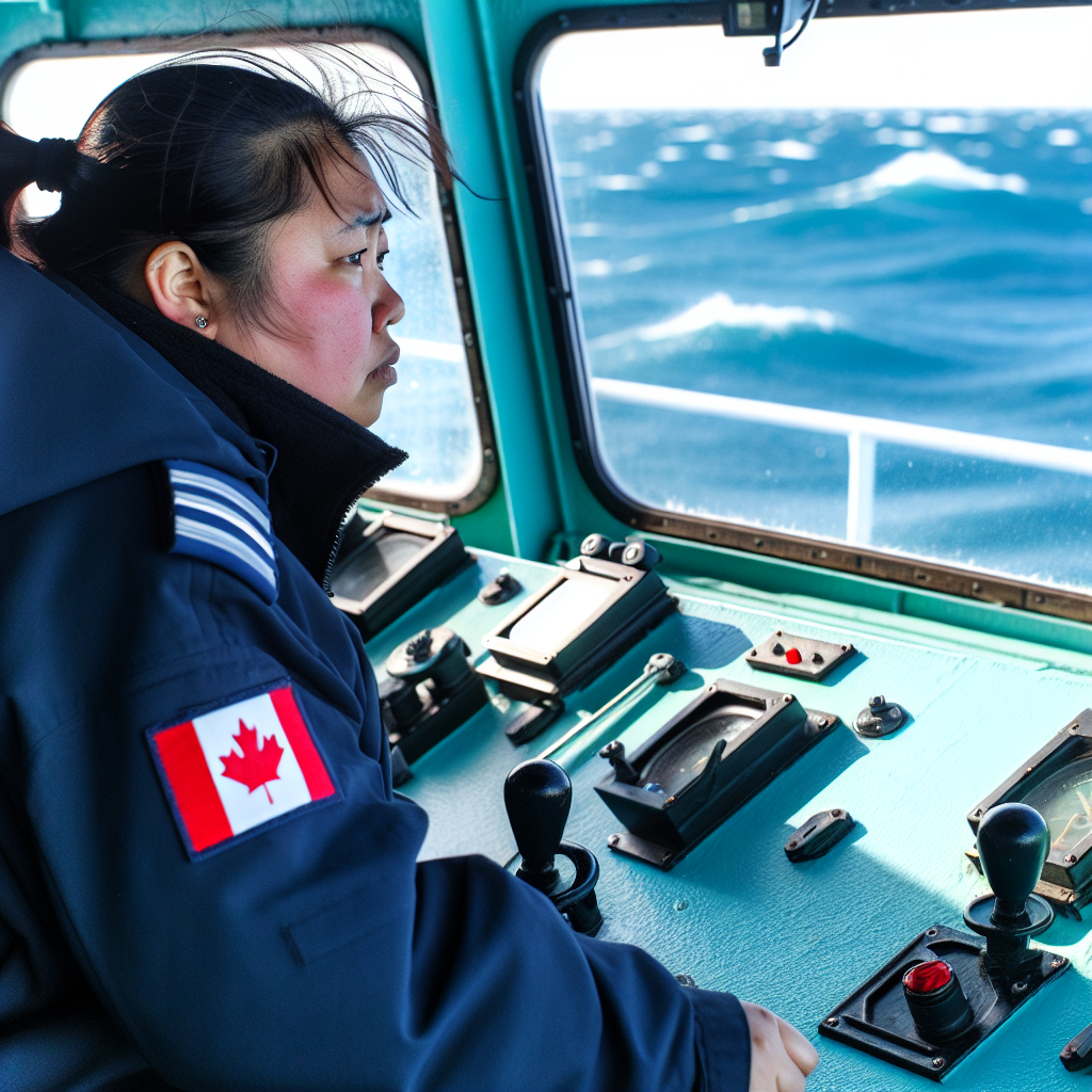
The bridge is the command center for maritime pilots.
Various equipment assists in navigation and communication.
Remote control systems allow for safe vessel maneuvering.
Communication tools keep pilots connected to port authorities.
Monitoring systems help assess vessel performance in real-time.
Weather Monitoring Tools
Weather conditions significantly impact maritime navigation.
Pilots use meteorological tools to assess weather patterns.
High-tech forecasting systems provide accurate data on conditions.
By understanding the weather, pilots can make informed decisions.
This capability enhances safety during transit.
Unlock Your Career Potential
Visualize a clear path to success with our tailored Career Consulting service. Personalized insights in just 1-3 days.
Get StartedImportance of Navigation Tools for Maritime Pilots
Navigation tools are vital for maritime pilots to ensure safe passage.
They navigate complex waterways where risks are prevalent.
A clear understanding of navigation tools enhances efficiency and safety.
Assessment of Weather Conditions
Weather plays a crucial role in maritime navigation.
Pilots rely on advanced meteorological data to make informed decisions.
Real-time weather information helps in planning safe routes.
Additionally, weather forecasts assist in avoiding severe conditions.
Use of GPS Technology
Global Positioning System (GPS) has transformed maritime navigation.
Pilots use GPS for precise location tracking and navigation accuracy.
This technology reduces human error significantly.
Moreover, it provides critical data to avert potential hazards.
Integration of Electronic Chart Systems
Electronic Chart Display and Information Systems (ECDIS) offer dynamic navigation solutions.
These systems provide real-time positioning on updated nautical charts.
Pilots can assess nearby vessels and obstacles effectively through ECDIS.
Furthermore, they ensure compliance with international regulations.
Utilization of Radar for Navigation
Radar technology is essential for detecting objects in poor visibility.
It enables pilots to identify hazards not visible to the naked eye.
Through radar, maritime pilots can track the movement of surrounding vessels.
This increases situational awareness and supports safe maneuvering.
Importance of Communication Tools
Effective communication is paramount for maritime operations.
Pilots use VHF radios to coordinate with vessel traffic services.
These communications help in making timely navigational decisions.
Furthermore, pilots maintain contact with other mariners for safety assurances.
Integration of Navigation Technologies
The integration of these tools is essential for modern maritime pilots.
They enable pilots to perform complex navigation tasks efficiently.
Ultimately, these navigation tools significantly enhance maritime safety.
Types of Navigation Tools Used by Maritime Pilots
Electronic Navigation Systems
Modern maritime pilots rely heavily on electronic navigation systems.
These systems provide real-time data on vessel location and navigation.
For example, GPS enables precise positioning of ships.
Additionally, Electronic Chart Display and Information Systems (ECDIS) enhance navigation safety.
These systems display up-to-date navigational charts and data.
Radar Technology
Radar technology plays a crucial role in maritime navigation.
Pilots use radar to detect other vessels, landmasses, and obstacles.
This tool ensures safe navigation, especially in limited visibility conditions.
Moreover, radar helps in determining the distance and speed of surrounding objects.
Consequently, pilots can make informed decisions to avoid collisions.
Traditional Navigation Tools
Despite advances in technology, traditional navigation tools remain relevant.
Charts and compasses are essential for maritime pilots.
Using paper charts allows pilots to track their course manually.
Additionally, magnetic compasses provide reliable heading information.
These tools are important backups during electronic failures.
Communication Equipment
Effective communication is vital for maritime operations.
Pilots use VHF radios to communicate with vessel crews and other pilots.
This equipment ensures clear instructions and coordination in busy waterways.
Furthermore, coordination with coast guard stations enhances safety.
Environmental Monitoring Equipment
Understanding environmental conditions is essential for navigation.
Pilots utilize equipment to monitor weather, tides, and currents.
This information helps in planning safe passages.
For instance, buoys equipped with sensors provide real-time data on water conditions.
Additionally, weather radar assists pilots in avoiding severe weather systems.
Find Out More: Skills Every Supply Chain Manager Should Master
Traditional Navigation Methods: Charts and Compasses
Navigational Charts
Navigational charts are essential for maritime pilots.
These charts depict coastlines, water depths, and navigational aids.
Pilots use them to understand the geography of waterways.
They read charts to plan safe routes between ports.
Bathymetric details help pilots gauge underwater obstacles.
Additionally, charts indicate traffic separation schemes.
This information aids in maintaining safe distances from other vessels.
Moreover, pilots update their charts regularly for accuracy.
Use of Compasses
Compasses are a staple in maritime navigation.
They provide pilots with crucial directional information.
Mariners use magnetic compasses to understand heading.
These compasses detect magnetic north, influencing navigation decisions.
Pilots also utilize gyrocompasses for more precise readings.
Gyrocompasses maintain orientation regardless of magnetic variations.
This technology enhances route planning accuracy significantly.
Integration of Charts and Compasses
Combining navigational charts and compasses is vital for pilots.
Pilots constantly cross-reference their compass readings with charts.
This practice minimizes errors during navigation.
Consistency in using these tools promotes overall safety.
Ultimately, accurate navigation supports efficient maritime operations.
See Related Content: The Importance of Teamwork in Aviation Maintenance
Modern Technology in Navigation: GPS and Electronic Chart Systems
Introduction to GPS Technology
GPS technology revolutionizes maritime navigation.
Pilots use GPS to determine their exact location.
This system utilizes satellites to provide real-time data.
Consequently, it enhances safety and efficiency in navigation.
Components of GPS Systems
GPS systems consist of several key components.
Satellites provide signals necessary for location detection.
Receivers process these signals to determine positions.
User segments interact with the GPS for navigation purposes.
Such integration allows for precise calculations of speed and direction.
Advantages of GPS in Maritime Navigation
GPS significantly improves navigational accuracy.
It reduces the chances of human error during voyages.
Additionally, it permits real-time updates on vessel positions.
This capability enhances fleet management and tracking.
Understanding Electronic Chart Systems
Electronic Chart Systems (ECS) complement GPS technology.
These systems display maritime charts digitally.
Pilots can overlay various data layers for better situational awareness.
Such layers include weather data, navigational aids, and hazards.
Key Features of Electronic Chart Systems
ECS technology offers multiple advantageous features.
Automatic updates ensure charts remain accurate and current.
User-friendly interfaces simplify navigation tasks for pilots.
Moreover, these systems often include route planning tools.
Combining GPS and ECS for Enhanced Navigation
The combination of GPS and ECS enhances maritime navigation.
Pilots benefit from an integrated approach to route management.
This synchronized workflow allows for more informed decision-making.
Furthermore, it promotes a higher level of operational safety.
Learn More: Certifications for Aspiring Aviation Maintenance Technicians
The Role of Radar and Sonar in Maritime Navigation
Introduction to Navigation Tools
Maritime pilots rely heavily on advanced navigation tools.
Two critical tools are radar and sonar systems.
These technologies enhance safety and efficiency at sea.
Understanding Radar Technology
Radar operates by sending out radio waves.
These waves bounce back after hitting objects.
Pilots can then determine the location of obstacles.
Moreover, radar assists in identifying other vessels.
This information is crucial for collision avoidance.
Benefits of Radar Systems
- Radar provides real-time information on surrounding waters.
- Pilots can detect objects even in poor visibility.
- This technology allows for better decision-making.
Examining Sonar Technology
Sonar technology plays a vital role in navigation.
Sonar uses sound waves to map underwater environments.
Pilots can identify submerged hazards effectively.
This capability is essential in narrow or shallow waters.
Benefits of Sonar Systems
- Sonar helps in locating underwater obstructions.
- Pilots can better understand the sea floor configuration.
- This enhances navigational accuracy and safety.
Integrating Radar and Sonar
Combining radar and sonar enhances overall navigation.
This integration provides comprehensive situational awareness.
Pilots can better navigate challenging maritime environments.
Ultimately, these tools contribute to safer voyages.
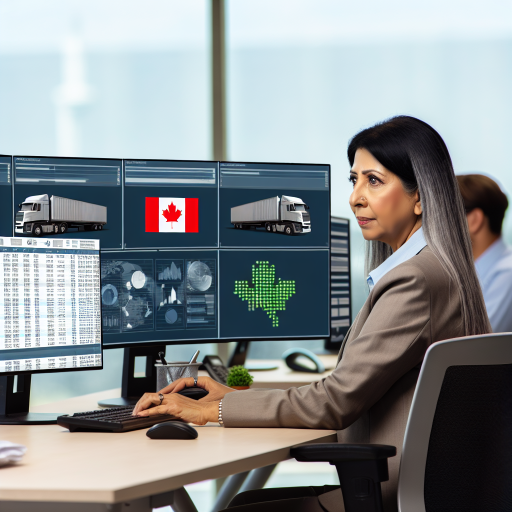
Find Out More: Challenges Canadian Fleet Managers Face Daily
Weather and Environmental Considerations in Piloting
Understanding Weather Patterns
Maritime pilots rely heavily on accurate weather data for safe navigation.
They analyze various weather patterns to anticipate changes.
Forecasts provide crucial information on wind, precipitation, and visibility.
Furthermore, pilots must consider local microclimates that may differ from broader forecasts.
Impact of Tides and Currents
Tides influence navigation significantly in coastal waters.
Pilots monitor tidal changes to avoid grounding their vessels.
Understanding current flow is also essential for efficient maneuvering.
In particular, they account for both surface and subsurface currents.
Environmental Regulations and Compliance
Pilots must stay updated on environmental regulations to ensure compliance.
Protected marine areas often have specific navigational restrictions.
Failure to comply can result in penalties and ecological harm.
Consequently, understanding these regulations enhances sustainable practices.
Using Technology for Navigation
Modern technology aids pilots in navigating challenging environments.
Advanced radar systems provide real-time data on weather and obstacles.
Additionally, GPS technology ensures accurate positioning throughout voyages.
These tools help mitigate risks associated with unpredictable weather.
Communicating with Other Vessels
Effective communication with nearby vessels enhances safety on the water.
Pilots utilize radio systems to exchange essential information quickly.
Furthermore, sharing weather updates can prevent collisions and mishaps.
Collaboration among ships enhances overall maritime safety.
Safety Protocols and Best Practices in Maritime Navigation
Understanding Safety Protocols
Safety protocols ensure the well-being of both crew and vessel.
Maritime pilots follow rigorous guidelines during navigation.
These protocols include regular safety drills and emergency preparations.
Role of Communication in Navigation
Effective communication prevents accidents at sea.
Pilots use radios to relay information to other vessels.
Clear communication enhances situational awareness among crews.
Utilizing Modern Technology
Modern technology greatly aids in navigation safety.
Pilots rely on GPS and radar systems for accurate positioning.
Chartplotters help in visualizing navigation routes clearly.
Implementing Best Practices
Best practices ensure safe and efficient navigation.
Pilots conduct thorough pre-voyage checks before departure.
They also regularly update nautical charts and publications.
Furthermore, continuous training enhances pilot skills.
Adapting to Weather Conditions
Weather significantly affects maritime navigation safety.
Pilots monitor forecasts to anticipate potential hazards.
They adjust routes accordingly to avoid severe weather.
Collaborating with Other Vessels
Collaboration with other vessels is vital for safe navigation.
Pilots exchange information about currents and obstacles.
Such collaboration fosters a safer navigational environment.
Case Studies: Successful Navigation Aids in Challenging Waters
Implementing Advanced Technologies
Modern maritime pilots rely heavily on advanced navigation technologies.
One successful case involved the integration of automatic identification systems.
This technology enhanced maritime traffic monitoring and safety.
Moreover, it enabled real-time data sharing among vessels.
Utilizing Traditional Techniques
Despite technological advances, traditional methods remain vital.
For example, celestial navigation plays a crucial role in emergency situations.
Pilots utilize sextants to determine their position when electronic devices fail.
This approach underscores the importance of skill and experience.
Case Study: The Port of Seattle
The Port of Seattle implemented innovative navigation solutions recently.
They incorporated sophisticated radar systems to improve safety.
This system helped monitor incoming and outgoing vessels effectively.
As a result, the port experienced a significant decrease in accidents.
Case Study: The Straits of Malacca
The Straits of Malacca present unique navigation challenges.
Dense traffic and shallow waters complicate piloting efforts.
Maritime pilots here employ a combination of tools.
These include electronic charts and local knowledge of tides.
Consequently, successful navigational strategies have developed in this region.
Lessons Learned from Each Case
Technology enhances navigation but does not replace fundamental skills.
Successful maritime navigation requires adaptability and continuous learning.
Each case illustrates different tools and strategies for varied conditions.
Ultimately, combining modern tools with traditional knowledge proves essential.
Additional Resources
Careers with the Canadian Coast Guard
Career Paths to the Okeanos: Deep Connections 2019: Exploring …